DiTwin: Revolutionizing road management with digital twin technology
The DiTwin research project focuses on the development of groundbreaking methods for monitoring the condition of road sections using digital twin technology. By integrating state-of-the-art sensor technology and advanced forecasting models, DiTwin aims to usher in a new era of road and asset management. This innovation promises not only more precise condition assessment but also optimized resource usage, leading to more sustainable and cost-efficient infrastructure management strategies.
From Data to Insights: The Path to Intelligent Condition Monitoring
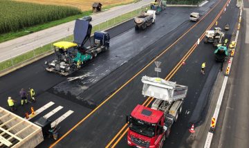
This research project aims to develop innovative approaches to assess the condition of an existing road section (living lab) by incorporating material and condition data. The generated data will be automatically analyzed using the concept of a digital twin of the living lab, with the goal of developing optimized forecasting models for road condition. This will enable more efficient resource utilization in road and asset management. Material and condition data from the living lab will be collected using permanently installed sensors and weigh-in-motion stations. Both existing sensors and newly installed sensors for detecting structural condition will be used.
In addition, bearing capacity measurements using a falling weight deflectometer and GVO-based laboratory tests on core samples from the living lab are planned. The digitalization of the living lab into a digital twin will include the use of 3D photogrammetry. For data exchange and communication between the sensor and measuring units of the living lab and the digital twin, a data and system design based on application-specific requirements is planned. A database for storing and managing different road graphs and referencing all sensor and measurement data will serve as the central element of a digital twin in the field of road superstructure.
Based on existing database systems, customized data storage solutions and adapted data ingestion and query methods will be designed and implemented as part of the research project. The goal of scalability for the DACH region will be considered. For visualizing the digital twin, including sensor data and results, the pros and cons of 2.5D, 3D, and dashboard views will be analyzed and the most suitable visualization technique will be selected in coordination with stakeholders.
The Future of Forecasting: Optimization Through Digital Twins
To understand the significance and potential of a digital twin for asset and pavement management by highway operators in the DACH region, systematic research, mathematical model analysis, and statistical evaluations will be conducted. Existing models will be reviewed and compared with newer developments to prepare them for use in the living lab. Based on the developed data and system structure, extended condition models for relevant damage features of the road superstructure will be derived from the collected living lab data using statistical analyses and their information gain will be evaluated. Simulations will be used to illustrate the impact of optimized planning on intervention timing and life cycle costs. In a further step, the scalability of the results to the network level and the transferability of the developed approaches to the high-ranking road network in the DACH region will be examined. As an important step in achieving climate goals on highways and expressways in the DACH region, potential reductions in user costs and emissions through optimized material selection will be highlighted.


Part of the project team at the 2023 kick-off, from left to right: Melina Rohne (RWTH Aachen), Markus Hoffmann (Hoffmann Consult), Serge Lamberty (RWTH Aachen), Paul Heinzlreiter (RISC Software), Martin Peyer (TU Wien), Stefanie Kritzinger-Griebler (RISC Software)
This project is funded by the FFG.

Project Partners


Project Details
- Project short title: DiTwin
- Project full title: Integrated data acquisition, innovative forecasting, and intuitive mapping of road conditions in a digital twin
- Project partners:
- Vienna University of Technology, Institute of Transportation Sciences (Consortium lead)
- Hoffmann Consult
- RWTH Aachen, Institute for Highway Engineering (external partner)
- Funding Call: Mobility System 2023: DACH Transport Infrastructure
- Total Budget: 686,051 euros
- Duration: 10/2023–09/2026 (36 months)
Contact Person
Project Lead

DI Paul Heinzlreiter
Senior Data Engineer


